Gatewing


Services

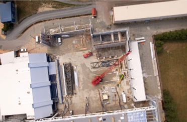
TrueSouth Aerial Mapping can produce and supply high quality orthophotos and accurate digital terrain models.
Applications for this service are practically unlimited and much of the data collected is supplied digitally ready for input into a GIS or CAD system.
Gatewing
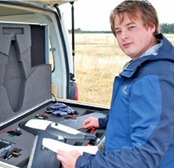
The Gatewing X100 is an Unmanned Aerial Vehicle (UAV). It is the tool we use for acquiring the digital photos needed to create orthophotos and digital terrain models.
The flight of the X100 is fully automated from launch to landing. It covers a pre-programmed area by parallel sweeps and takes consecutive, overlapping camera shots. The resulting data consists of a number of pictures that are tagged with their GPS co-ordinates.
The images collected using the Gatewing X100 are then combined in a photogrammetry programme to produce the final products.
If you have any questions regarding the possibilities presented by this technology please do not hesitate to contact us.